Maps in Kindergarten: Rosie’s Walk
By Kayla • April 3, 2018

Even in the age of GPS and MapQuest, it's important for your students to orient themselves with maps as well as practice giving and following directions. Patricia Bentham, creator of Kindergarten-Lessons, suggests using Pat Hutchins' Rosie's Walk to introduce classroom map activities.
Lesson Objectives
- Assess what students already know about maps (i.e. why they're important, what they're used for, types, etc.).
- Introduce and practice the concept of sequencing.
- Learn about the concept of viewpoint.
- Learn how to create a map.
Lesson Activities
 |
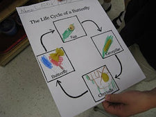
Bentham suggests introducing the concepts of sequencing and mapmaking by having students create a story map. Provide students with a piece of card stock and walk them through creating a map of the barnyard including the important landmarks that Rosie visited on her walk. Students can design landmarks with graphic art tools, construction cutouts, etc. When finished help students re-tell the story using their maps. |
 |
To learn about viewpoints, Bentham suggests designing a fun, hands-on exercise. Using blocks from the classroom play center, she suggests creating a small village with several buildings. Equipped with crayons and a small blank booklet, have your students observe and draw the 'village' from different viewpoints (i.e. from the side, from the top, etc.). Have them predict which viewpoint real maps are drawn from then show them several maps of your area as you discuss the topic further. |
 |
To further strengthen student mapmaking skills and introduce map functions, consider dividing the classroom into small sections. Assign a section to each student, inviting them to observe and draw what they see (adding labels if they can). When finished, assemble each child's drawing to create a large map of the room. Examine the map as a class, determining whether a new student or parent would be able to navigate the classroom and find each important center, station, etc. Ask students whether there are any details they should add by asking them about the map's functionality (i.e. will a new student know where to place completed classwork, how to sign in every morning, where to hang their coat, etc.). |
 |
Create a slideshow of the different types of maps (i.e. physical, topographic, etc.). Discuss how each is used and have your students brainstorm why each is important. |
At the end of the lesson, students should have a pretty good grasp of how maps are used, why they're important, and how to make their own! For helpful lesson pictures and greater activity detail, be sure to read Bentham's full post!
About the Author

Kayla Johnson

Disclaimer: The content on this page is for informational purposes only and reflects the author's personal experiences and/or opinions. The author is not a financial advisor, medical professional, or licensed expert in any regulated field. Nothing on this page should be interpreted as financial, medical, or professional advice. This content is not a substitute for professional advice, diagnosis, or treatment.
Always consult a qualified professional before making decisions related to your finances, health, or other personal matters. The information provided here is shared in good faith, but individual circumstances vary, and what works for some people may not work for you. Results are not typical, implied, or guaranteed. While we strive for accuracy, information may become outdated or change over time. Statements made by guest authors reflect their own opinions and should not be interpreted as endorsements by SupplyMe.
Some of the links on this page may be affiliate or referral links, which means we may earn a commission or bonus if you use them. There’s no extra cost to you — and it’s a great way to support the site if you find the content helpful.